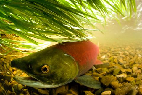
The Salmon Landscapes monitoring portal was co-developed by regional experts working in the Cascadia region to support joint assessment and monitoring of landscape change within salmon watersheds.
Salmon Landscapes is designed to facilitate large-scale, dynamic, and historical joint assessment and monitoring of the terrestrial landscape within salmon and steelhead watersheds, provide tools that help communicate change and threats to salmon habitats, and support ridgetop-to-river decision making for salmon.
The portal utilizes environmental monitoring layers developed for the transboundary Cascadia region and covering 1984 to present, and watershed ranges for salmonid species. These datasets help answer questions about the extent and location of landscape changes including urbanization and forest disturbance, and the current habitat condition in salmon watersheds including floodplain connectivity, road densities, forest structure, and forest harvest. A watershed resilience index enables the holistic assessment of watershed condition for salmon based on known terrestrial landscape stressors.
Use the layers in the app to view the current status of the landscape, assess the location and extent of change since 1984, or view forward climate projections. Overlays provide further insights for watersheds, salmon distributions, and management and monitoring regions.. See the user guide for more information on how the layers and watershed resilience index are calculated. The portal and datasets are dynamic, with layer updates and additions planned for 2026.
Salmon Landscapes Portal
VISIT THE CASCADIA SALMON LANDSCAPES MONITORING PORTAL (Beta Version 1.0)
User Guide
Please note the portal and features are still in development. You may encounter bugs using the app, downloading datasets, or viewing plots.
Bulk Data Downloads
Spatial data created for this project is available to download and use, including the seamless transboundary watersheds and salmon species watersheds. Annual landscape covariate data has also been pre-calculated for each HUC12 and BC Freshwater Atlas Assessment Watershed.
Landscape data
Annual Watershed Covariates v2025
Salmon distribution data
Transboundary Salmon Landscapes Watersheds (SWIFD and BC ZOIs)
Transboundary species watershed distributions (SWIFD and BC ZOIs)
Other spatial data
Transboundary harmonized watersheds (USGS HUC12 and BC Freshwater Atlas Assessment Watersheds)
Transboundary harmonized sub-basins (USGS HUC8 and BC Freshwater Atlas Group Watersheds)